Visualizing your Contaminated Site: Static Pictures are so 20th Century
by Patrick O’Neill
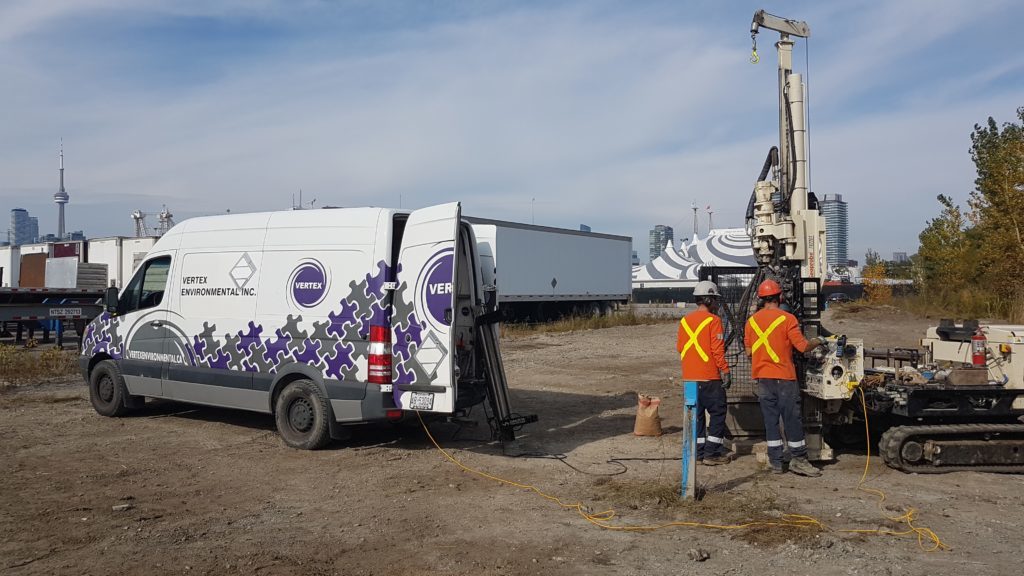
Ever since we started our High Resolution Site Characterization (HRSC) journey here at Vertex it feels like data acquisition and manipulation has moved at warp speed! When we first started out in this journey our deliverables in those early days were so rudimentary compared to what we deliver now.
Fast forward to 2018 and the technology/software has come a long way from where it was in 2010 when we started this ride. In particular the three dimensional (3D) visualizations were non-existent when we started and are now available in an interactive format for any and all of our clients. Not only can we provide this for our clients for any HRSC datasets including:
- Laser Induced Fluorescence (LIF);
- Membrane Interface Probe (MIP);
- Low Level Membrane Interface Probe (LLMIP); and
- Hydraulic Profiling Tool (HPT).
But also traditional soil and groundwater analytical data can be visualized in 3D as well! We’ve completed a few of these projects when enough data is available and some impressive visualizations were generated!
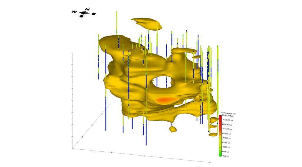
HRSC Data Visualized in 3D
They say “a picture is worth a thousand words.” These are very powerful visual tools to be able to quickly and efficiently show subsurface impacts to clients and colleagues. I am always very happy to provide these types of the visualizations based on the data collected on-Site for our clients and show how clear the new picture of the Site can be! So, if a single still picture is worth a thousand words, what would an interactive 3D visualization where an infinite number of pictures could be sourced/taken? Googolplex?! Kajillion?!
I believe this is the future of how Site assessment is going to be completed in Canada and across the world. With the tools catching on in Canada over the past several years, clients are utilizing the data to refine their Conceptual Site Models (CSMs), fill in data gaps that previously were unknown, or update/measure the performance of remediation activities on-Site. With the ability to process large amounts of data in relatively small amounts of time and easily transmit this data across the globe and the emerging Virtual Reality (VR) technology there is no telling where the future of HRSC will go and how the Environmental Industry will evolve!
We look forward to continue to pioneer the HRSC services and how best to communicate the results to our clients that help them make more informed decisions in the future here in Canada!
Related Articles by Vertex
Check out these related articles listed below by Vertex: