
Canada’s Massive Remediation Effort
The Goose Bay Military Base
Located in the central part of Labrador, Happy Valley Goose Bay is home to the largest military air base in northeastern North America, CFB Goose Bay, commonly referred to as 5 Wing Goose Bay.
In the summer of 1941, a large sandy plateau near the mouth of the Goose River was selected as the location to build the Goose Bay Air Force Base. The mounting pressures of World War II led to the building of an operational military airport in five months. The base hosted American and British detachments and since the 1970s has served as a low-level flight training base for NATO forces.
In the summer of 2009, the Minister of National Defence announced a $300-million investment for the 5 Wing Goose Bay Remediation Project (GBRP). Soil and groundwater impacts at 5 Wing Goose Bay can be attributed to past storage and handling practices of contaminants such as hydrocarbons, heavy metals, chlorinated compounds (PCBs), pesticides, etc.
Initial site assessments are complete and remediation activities are well underway at the historic site. There are several sub-projects planned in a phased approach, with remediation completion scheduled for 2020.
Remediation approaches include multi-phase extraction (MPE), soil excavation, and monitored natural attenuation.
Some impacted zones are estimated to contain over 1 million litres of free phase petroleum, spread out over expansive areas and down to depths in excess of 30 m below grade. Investigations have relied on traditional drilling and sampling techniques, yet the government sought greater efficiencies in sampling and detection to better understand the contaminant distribution, and to better direct the remediation activities.
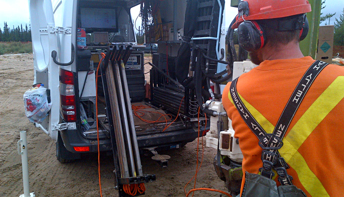
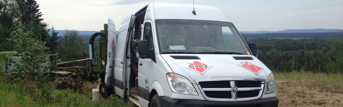
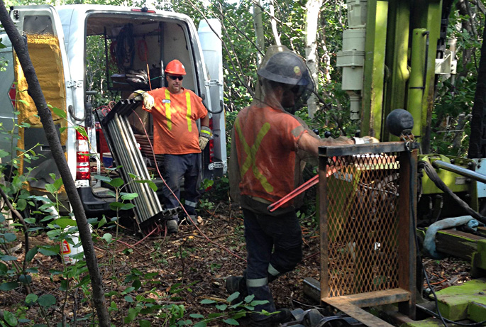
In 2012 and 2013, Vertex was awarded contracts to aid in the delineation effort using high resolution characterization tools, namely Laser Induced Fluorescence (LIF), Hydraulic Profile Tool (HPT) and Membrane Interface Probes (MIP).
Traditional drilling techniques allow for the installation of a handful of monitoring wells and samples to be collected each day. By contrast, with high resolution characterization techniques hundreds to thousands of data points are collected daily, allowing for the creation of detailed vertical and horizontal profiles at the Site. This amount of data provided in real time and reviewed via 3-D modelling has permitted better understanding of the petroleum hydrocarbon distribution, and additionally, provided a better understanding on how the MPE systems are affecting the LNAPL distribution.
Earlier this year, Vertex is proud to have been awarded a 3 year contract to provide high resolution services at the army base. We are currently working in Goose Bay, and will return in 2015 and 2016 for additional data collection.
Given the scope and scale of the impacted zones, the routine collection of high resolution data during and after active remediation has and will aid in the decision making process. The reams of compiled data will result in better and faster decisions for planning of the remediation work flow.
The efforts at 5 Wing Goose Bay illustrate the need for synergistic approaches to tackle large, multi-year, complex remediation projects. Traditional drilling techniques and excavation strategies are supported by modern characterization tools, natural attenuation, and enhanced multiphase contaminant recovery processes. The combination of technologies and approaches will be the key to efficiently reaching the targeted remediation deadline of 2020.
Until next time: Excellence is Your Choice!