Overview
 An historic landfill located in Southern Ontario was used for disposing of everything from household waste to industrial waste chemicals from bulk storage facilities. An extensive monitoring well installation and barrier wall was completed in previous years at the Site. Downgradient groundwater monitoring wells adjacent to a surface water body had flowable light, non-aqueous phase liquid (LNAPL) migrating into them that required regular purging. Plume delineation was required to understand the full extent of the LNAPL issue. The laser induced fluorescence (LIF) technology was selected as a cost-effective approach to 3D delineation.
Scope of Work
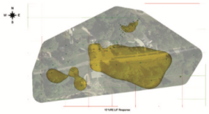
Vertex mobilized high resolution site characterization tools to the site for rapid in-situ delineation. The LIF delineated the horizontal and vertical extents of the LNAPL plume and determined that the bulk of the LNAPL plume was located in a very thin geological band within the subsurface.
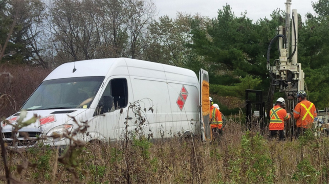
The Vertex Approach
High resolution site characterization was deployed by Vertex for seven days to delineate in 3D the LNAPL impacts in the subsurface. Vertex was able to profile 84 points for a total of 301 vertical meters. The results from the LIF survey revealed that this historic LNAPL plume was still migrating. Monitoring wells subsequently installed in areas without prior LNAPL detection had over a meter of LNAPL present 6 months later. The added data from the LIF survey is being used for to update the barrier design for the site.